 |
| (Wikimedia) |
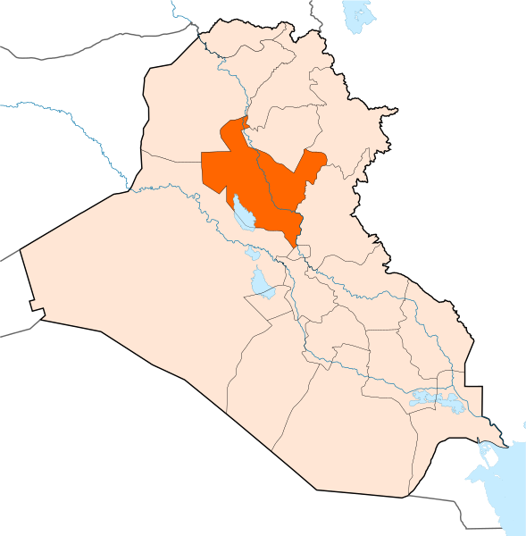
Anbar’s Rankings
Population #7
Most Urban #13
% Living Below National Poverty Line #13
% Of Households In Lowest Per Capita Expenditure Quintile #5
% Enrolled In Primary Schools #4
% Enrolled in Secondary Schools #3
Women Enrolled In Primary Schools Compared To Men #12
Illiteracy Rate #15
% Of Women Working In Non-Agricultural Sector #9
Under Five Mortality Rate #16
% Using Improved Drinking Water Source #6
% Using Improved Sanitation Facility #2
 |
| (Wikimedia) |
Babil’s Rankings
Population #5
Most Urban #12
% Living Below National Poverty Line #2
% Of Households In Lowest Per Capita Expenditure Quintile #8
% Enrolled In Primary Schools #13
% Enrolled in Secondary Schools #6
Women Enrolled In Primary Schools Compared To Men #14
Illiteracy Rate #11
% Of Women Working In Non-Agricultural Sector #8
Under Five Mortality Rate #17
% Using Improved Drinking Water Source #16
% Using Improved Sanitation Facility #11
 |
| (Wikimedia) |
Baghdad’s Rankings
Population #1
Most Urban #1
% Living Below National Poverty Line #14
% Of Households In Lowest Per Capita Expenditure Quintile #18
% Enrolled In Primary Schools #5
% Enrolled in Secondary Schools #1
Women Enrolled In Primary Schools Compared To Men #2
Illiteracy Rate #17
% Of Women Working In Non-Agricultural Sector #3
Under Five Mortality Rate tied #11
% Using Improved Drinking Water Source #4
% Using Improved Sanitation Facility #1
 |
| (Wikimedia) |
Basra’s Rankings
Population #3
Most Urban #2
% Living Below National Poverty Line #8
% Of Households In Lowest Per Capita Expenditure Quintile #16
% Enrolled In Primary Schools #9
% Enrolled in Secondary Schools #5
Women Enrolled In Primary Schools Compared To Men #4
Illiteracy Rate #14
% Of Women Working In Non-Agricultural Sector #5
Under Five Mortality Rate #13
% Using Improved Drinking Water Source #18
% Using Improved Sanitation Facility #15
 |
| (Wikimedia) |
Dhi Qar’s Rankings
Population #6
Most Urban #11
% Living Below National Poverty Line #9
% Of Households In Lowest Per Capita Expenditure Quintile #1
% Enrolled In Primary Schools #16
% Enrolled in Secondary Schools #12
Women Enrolled In Primary Schools Compared To Men #17
Illiteracy Rate #7
% Of Women Working In Non-Agricultural Sector #10
Under Five Mortality Rate tied #11
% Using Improved Drinking Water Source #15
% Using Improved Sanitation Facility #14
 |
| (Wikimedia) |
Diyala’s Rankings
Population #9
Most Urban #18
% Living Below National Poverty Line #7
% Of Households In Lowest Per Capita Expenditure Quintile #7
% Enrolled In Primary Schools #1
% Enrolled in Secondary Schools #2
Women Enrolled In Primary Schools Compared To Men #7
Illiteracy Rate #18
% Of Women Working In Non-Agricultural Sector #1
Under Five Mortality Rate #9
% Using Improved Drinking Water Source #12
% Using Improved Sanitation Facility #4
 |
| (Wikimedia) |
Dohuk’s Rankings
Population #18
Most Urban #4
% Living Below National Poverty Line #16
% Of Households In Lowest Per Capita Expenditure Quintile #12
% Enrolled In Primary Schools #6
% Enrolled in Secondary Schools #16
Women Enrolled In Primary Schools Compared To Men #6
Illiteracy Rate #1
% Of Women Working In Non-Agricultural Sector #15
Under Five Mortality Rate tied #4
% Using Improved Drinking Water Source #1
% Using Improved Sanitation Facility #3
 |
| (Wikimedia) |
Irbil’s Rankings
Population #10
Most Urban #3
% Living Below National Poverty Line #17
% Of Households In Lowest Per Capita Expenditure Quintile #17
% Enrolled In Primary Schools #7
% Enrolled in Secondary Schools #4
Women Enrolled In Primary Schools Compared To Men #5
Illiteracy Rate #5
% Of Women Working In Non-Agricultural Sector #2
Under Five Mortality Rate #3
% Using Improved Drinking Water Source #3
% Using Improved Sanitation Facility #18
 |
| (Wikimedia) |
Karbala’s Rankings
Population #14
Most Urban #8
% Living Below National Poverty Line #4
% Of Households In Lowest Per Capita Expenditure Quintile #4
% Enrolled In Primary Schools #8
% Enrolled in Secondary Schools #17
Women Enrolled In Primary Schools Compared To Men #9
Illiteracy Rate #12
% Of Women Working In Non-Agricultural Sector #12
Under Five Mortality Rate #2
% Using Improved Drinking Water Source #7
% Using Improved Sanitation Facility #6
 |
| (Wikimedia) |
Maysan’s Rankings
Population #15
Most Urban #9
% Living Below National Poverty Line #10
% Of Households In Lowest Per Capita Expenditure Quintile #11
% Enrolled In Primary Schools #18
% Enrolled in Secondary Schools #9
Women Enrolled In Primary Schools Compared To Men #18
Illiteracy Rate #8
% Of Women Working In Non-Agricultural Sector #13
Under Five Mortality Rate tied #11
% Using Improved Drinking Water Source #10
% Using Improved Sanitation Facility #17
 |
| (Wikimedia) |
Muthanna’s Rankings
Population #17
Most Urban #17
% Living Below National Poverty Line #1
% Of Households In Lowest Per Capita Expenditure Quintile #2
% Enrolled In Primary Schools #17
% Enrolled in Secondary Schools #18
Women Enrolled In Primary Schools Compared To Men #15
Illiteracy Rate #3
% Of Women Working In Non-Agricultural Sector #17
Under Five Mortality Rate tied #6
% Using Improved Drinking Water Source #17
% Using Improved Sanitation Facility #13
 |
| (Wikimedia) |
Najaf’s Rankings
Population #16
Most Urban #7
% Living Below National Poverty Line #11
% Of Households In Lowest Per Capita Expenditure Quintile #13
% Enrolled In Primary Schools #14
% Enrolled in Secondary Schools #8
Women Enrolled In Primary Schools Compared To Men #1
Illiteracy Rate #9
% Of Women Working In Non-Agricultural Sector #11
Under Five Mortality Rate #8
% Using Improved Drinking Water Source #7
% Using Improved Sanitation Facility #6
 |
| (Wikimedia) |
Ninewa’s Rankings
Population #2
Most Urban #10
% Living Below National Poverty Line #12
% Of Households In Lowest Per Capita Expenditure Quintile #10
% Enrolled In Primary Schools #10
% Enrolled in Secondary Schools #15
Women Enrolled In Primary Schools Compared To Men #10
Illiteracy Rate #12
% Of Women Working In Non-Agricultural Sector #11
Under Five Mortality Rate tied #6
% Using Improved Drinking Water Source #9
% Using Improved Sanitation Facility #7
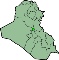
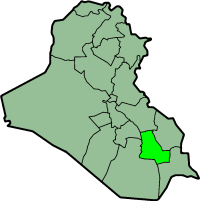
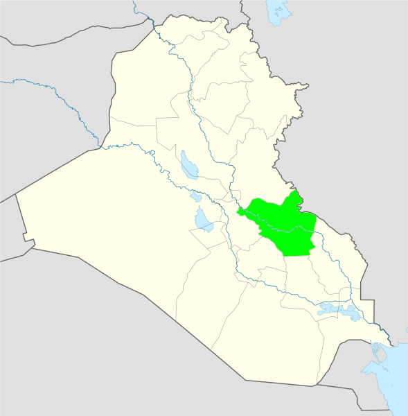
Qadisiyah’s economy is dominated by agriculture. It provides 47% of the GDP, and 35% of jobs. The province mainly produces rice, wheat, and barley. 46% of jobs are unwaged, mostly in farming. That’s the main reason why 33.7% of households live in the lowest per capita expenditure quintile, and 35.0% live below the national poverty line of $2.20 per day.
Qadisiyah’s Rankings
Population #12
Most Urban #14
% Living Below National Poverty Line #5
% Of Households In Lowest Per Capita Expenditure Quintile #3
% Enrolled In Primary Schools #15
% Enrolled in Secondary Schools #10
Women Enrolled In Primary Schools Compared To Men #16
Illiteracy Rate #6
% Of Women Working In Non-Agricultural Sector #7
Under Five Mortality Rate #10
% Using Improved Drinking Water Source #11
% Using Improved Sanitation Facility #16
 |
| (Wikimedia) |
Salahaddin’s Rankings
Population #8
Most Urban #16
% Living Below National Poverty Line #3
% Of Households In Lowest Per Capita Expenditure Quintile #14
% Enrolled In Primary Schools #12
% Enrolled in Secondary Schools #13
Women Enrolled In Primary Schools Compared To Men #13
Illiteracy Rate #13
% Of Women Working In Non-Agricultural Sector #16
Under Five Mortality Rate #15
% Using Improved Drinking Water Source #13
% Using Improved Sanitation Facility #10
 |
| (Wikimedia) |
Sulaymaniya’s Rankings
Population #4
Most Urban #5
% Living Below National Poverty Line #18
% Of Households In Lowest Per Capita Expenditure Quintile #14
% Enrolled In Primary Schools #2
% Enrolled in Secondary Schools #7
Women Enrolled In Primary Schools Compared To Men tied #2
Illiteracy Rate #2
% Of Women Working In Non-Agricultural Sector #4
Under Five Mortality Rate #15
% Using Improved Drinking Water Source #5
% Using Improved Sanitation Facility #9
 |
| (Wikimedia) |
Tamim’s Rankings
Population #13
Most Urban #6
% Living Below National Poverty Line #3
% Of Households In Lowest Per Capita Expenditure Quintile #14
% Enrolled In Primary Schools #3
% Enrolled in Secondary Schools #11
Women Enrolled In Primary Schools Compared To Men #8
Illiteracy Rate #16
% Of Women Working In Non-Agricultural Sector #6
Under Five Mortality Rate #18
% Using Improved Drinking Water Source #2
% Using Improved Sanitation Facility #5
 |
| (Wikimedia) |
Wasit’s Rankings
Population #11
Most Urban #15
% Living Below National Poverty Line #6
% Of Households In Lowest Per Capita Expenditure Quintile #6
% Enrolled In Primary Schools #11
% Enrolled in Secondary Schools #14
Women Enrolled In Primary Schools Compared To Men #11
Illiteracy Rate #4
% Of Women Working In Non-Agricultural Sector #14
Under Five Mortality Rate tied #4
% Using Improved Drinking Water Source #14
% Using Improved Sanitation Facility #12
Iraq’s Provinces’ Information
Population (2007 estimates)
Baghdad 7,145,470
Ninewa 2,811,091
Basra 1,912,533
Sulaymaniya 1,893,617
Babil 1,651,565
Dhi Qar 1,616,226
Anbar 1,485,985
Salahaddin 1,191,403
Diyala 1,560,621
Irbil 1,542,421
Wasit 1,064,950
Qadisiyah 990,483
Tamim 902,019
Karbala 887,859
Maysan 824,147
Najaf 614, 997
Muthanna 614,997
Dohuk 505,491
Most Urban (2007)
87% Baghdad
78% Basra
76% Irbil
73% Dohuk
70% Sulaymaniya
69% Tamim
68% Najaf
65% Karbala
65% Maysan
61% Ninewa
58% Dhi Qar
53% Babil
52% Anbar
52% Qadisiyah
52% Wasit
46% Salahaddin
44% Muthanna
41% Diyala
Most Rural (2007)
59% Diyala
56% Muthanna
54% Salahaddin
48% Anbar
48% Qadisiyah
48% Wasit
47% Babil
42% Dhi Qar
39% Ninewa
35% Karbala
35% Maysan
31% Najaf
31% Tamim
30% Sulaymaniya
27% Dohuk
24% Irbil
21% Basra
13% Baghdad
% Living Below National Poverty Line ($2.20 per day)
22.9% Iraq
48.8% Muthanna
41.2% Babil
39.9% Salahaddin
36.9% Karbala
35.0% Qadisiyah
34.8% Wasit
33.1% Diyala
32.1% Basra
32.0% Dhi Qar
25.3% Maysan
24.4% Najaf
23.0% Ninewa
20.9% Anbar
13.0% Baghdad
9.8% Tamim
9.3% Dohuk
3.4% Irbil
3.3% Sulaymaniya
Households In Lowest Per Capita Expenditure Quintile By Province
20.0% Iraq
44.7% Dhi Qar
41.0% Muthanna
33.7% Qadisiyah
32.9% Karbala
32.2% Anbar
32.2% Wasit
30.1% Diyala
27.9% Babil
26.8% Tamim
26.0% Ninewa
25.2% Maysan
18.1% Dohuk
15.4% Najaf
15.2% Salahaddin
10.1% Sulaymaniya
9.8% Basra
7.1% Irbil
6.7% Baghdad
 |
| (Global Security) |
Click on map for larger view
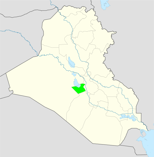
Households In Lowest Per Capita Expenditure Quintile By District
20.0% Iraq
62.2% Baladrooz, Diyala
61.8% Chibayish, Dhi Qar
59.6% Shatra, Dhi Qar
58.2% Tal Afar, Ninewa
55.4% Shamiya, Qadisiyah
52.9% Rumaitha, Muthanna
51.1% Salman, Muthanna
48.9% Hawija, Tamim
47.6% Shirqat, Salahaddin
46.9% Afaq, Qadisiyah
46.2% Rifai, Dhi Qar
45.3% Fallujah, Anbar
43.1% Khalis, Diyala
42.7% Nasiriyah, Dhi Qar
42.2% Fars, Salahaddin
42.2% Hatra, Ninewa
40.4% Maimouna, Maysan
40.0% Ain Tamur, Karbala
39.1% Khidhir, Muthanna
38.7% Hashimiya, Babil
37.9% Tilkaif, Ninewa
37.8% Daquq, Tamim
37.3% Suwair, Wasit
36.9% Hindiya, Karbala
36.4% Hamdaniya, Ninewa
36.0% Ali al-Gharbi, Maysan
35.8% Shikhan, Ninewa
35.6% Kahla, Maysan
33.8% Mahawil, Babil
33.3% Baquba, Diyala
33.3% Kut, Wasit
32.9% Ramadi, Anbar
32.4% Hai, Wasit
32.0% Musayyib, Babil
31.1% Aziziya, Wasit
31.1% Qalat Saleh, Maysan
31.1% Rawa, Anbar
30.7% Sinjar, Ninewa
30.2% Karbala, Karbala
30.0% Aqri, Ninewa
29.3% Dibis, Tamim
29.3% Meja al-Kabi, Maysan
28.9% Pshdar, Sulaymaniya
28.9% Samawa, Muthanna
28.0% Kaim, Anbar
26.3% Manathera, Najaf
25.8% Namaniya, Wasit
24.2% Kufa, Najaf
22.7% Rania, Sulaymaniya
21.8% Suq al-Shoyokh, Dhi Qar
21.1% Baaj, Ninewa
20.9% Midaina, Basra
20.9% Sharbazher, Sulaymaniya
20.9% Sumel, Dohuk
20.4% Penjwin, Sulaymaniya
20.0% Badra, Wasit
19.6% Chamchamal, Sulaymaniya
19.6% Diwaniya, Qadisiyah
19.1% Qurna, Basra
18.9% Koisnjaq, Irbil
18.7% Fao, Basra
18.7% Rutba, Anbar
17.8% Hillah, Babil
17.4% Touz, Salahaddin
17.3% Amarah, Maysan
16.9% Hit, Anbar
16.9% Najaf, Najaf
16.9% Kirkuk, Tamim
16.0% Abu al-Khasib, Basra
16.0% Khanaqin, Diyala
14.7% Mosul, Ninewa
13.8% Daur, Salahaddin
12.9% Amedia, Dohuk
12.9% Zakho, Dohuk
12.7% Rusafa, Baghdad
12.7% Tharwa 1, Baghdad
12.7% Tharwa 2, Baghdad
11.6% Dohuk, Dohuk
11.1% Dokan, Sulaymaniya
10.9% Kifri, Diyala
10.7% Shaqlawa, Irbil
10.2% Samarra, Salahaddin
9.8% Halabja, Sulaymaniya
9.1% Irbil, Irbil
8.7% Kadhimaiyah, Baghdad
8.4% Ana, Anbar
8.4% Tikrit, Salahaddin
8.3% Hamza, Qadisiyah
8.0% Basra, Basra
7.8% Soran, Irbil
7.1% Haditha, Anbar
6.7% Makhmour, Irbil
6.7% Mergasur, Irbil
5.8% Shatt al-Arab, Basra
5.4% Madain, Baghdad
5.2% Karkh, Baghdad
4.4% Balad, Salahaddin
4.4% Choman, Irbil
4.4% Darbandihkan, Sulaymaniya
3.6% Kalar, Sulaymaniya
2.2% Sulaymaniya, Sulaymaniya
2.0% Abu Ghraib, Baghdad
1.7% Adhamiya, Baghdad
1.3% Muqtadiya, Diyala
1.2% Mahmudiyah, Baghdad
0.9% Baiji, Salahaddin
0.3% Tarmiyah, Baghdad
N/A Tharthar, Salahaddin
% Enrolled in Primary Schools
84.8% Iraq
92.2% Diyala
91.4% Sulaymaniya
90.7% Tamim
90.1% Anbar
90.0% Baghdad
89.8% Dohuk
89.6% Irbil
88.9% Karbala
86.6% Basra
81.7% Ninewa
79.5% Wasit
78.3% Salahaddin
78.2% Babil
78.2% Najaf
78.1% Qadisiyah
77.9% Dhi Qar
75.3% Muthanna
65.6% Maysan
% Enrolled in Secondary Schools
36.7% Iraq
42.0% Baghdad
35.8% Diyala
34.8% Anbar
29.7% Irbil
24.9% Basra
24.1% Babil
22.8% Sulaymaniya
22.1% Najaf
21.2% Maysan
17.9% Qadisiyah
17.7% Tamim
15.8% Dhi Qar
14.7% Salahaddin
13.8% Wasit
13.5% Ninewa
12.0% Dohuk
10.6% Karbala
9.8% Muthanna
Women Enrollment Compared To Men In Primary Schools
84.8% Iraq
110% Najaf
100% Baghdad
100% Sulaymaniya
99.8% Basra
99.4% Irbil
96.8% Dohuk
96.5% Diyala
96.2% Tamim
95.7% Karbala
93.4% Ninewa
91.% Wasit
91.2% Anbar
87.2% Salahaddin
83.2% Babil
83.0% Muthanna
82.1% Qadisiyah
81.7% Dhi Qar
79.1% Maysan
Illiteracy Aged 10+ By Province
17.5% Iraq
30.5% Dohuk
27.8% Sulaymaniya
26.8% Muthanna
25.9% Wasit
25.8% Irbil
24.9% Qadisiyah
22.8% Dhi Qar
21.5% Maysan
20.9% Najaf
20.9% Ninewa
19.6% Babil
17.2% Karbala
15.7% Salahaddin
14.6% Basra
13.9% Anbar
11.9% Tamim
10.0% Baghdad
6.8% Diyala
Illiteracy Aged 10+ By District
17.5% Iraq
51.8% Salman, Muthanna
49.0% Hatra, Ninewa
43.0% Choman, Irbil
41.7% Aqri, Ninewa
41.2% Sinjar, Ninewa
38.4% Chamchamal, Sulaymaniya
38.3% Qalat Saleh, Maysan
38.0% Pshdar, Sulaymaniya
36.8% Penjwin, Sulaymaniya
35.9% Kahla, Maysan
35.1% Mergasur, Irbil
34.7% Khidhir, Muthanna
33.9% Hai, Wasit
33.6% Fars, Salahaddin
33.2% Hamza, Qadisiyah
33.0% Rania, Sulaymaniya
32.9% Sharbazher, Sulaymaniya
32.9% Shikhan, Ninewa
32.6% Dokan, Sulaymaniya
32.6% Shaqlawa, Irbil
32.5% Ali al-Gharbi, Maysan
31.5% Chibayish, Dhi Qar
31.5% Shamiya, Qadisiyah
31.2% Maimouna, Maysan
30.9% Amedia, Dohuk
30.6% Koisnjaq, Irbil
30.2% Soran, Irbil
29.7% Rutba, Anbar
29.3% Namaniya, Wasit
29.3% Suwair, Wasit
29.2% Sumel, Dohuk
29.1% Kalar, Sulaymaniya
29.1% Rumaitha, Muthanna
29.0% Irbil, Irbil
29.0% Zakho, Dohuk
28.6% Ain Tamur, Karbala
27.5% Shatra, Dhi Qar
27.3% Midaina, Basra
26.4% Halabja, Sulaymaniya
26.3% Manathera, Najaf
26.3% Rawa, Anbar
26.2% Afaq, Qadisiyah
26.1% Daquq, Tamim
26.1% Kifri, Diyala
25.7% Darbandihkan, Sulaymaniya
25.7% Suq al-Shoyokh, Dhi Qar
25.6% Samarra, Salahaddin
25.4% Dohuk, Dohuk
25.4% Rifai, Dhi Qar
24.6% Baaj, Ninewa
24.2% Kufa, Najaf
23.4% Hashimiya, Babil
23.4% Makhmour, Irbil
23.3% Meja al-Kabi, Maysan
23.0% Aziziya, Wasit
23.0% Fao, Basra
23.0% Hindiya, Karbala
22.8% Tal Afar, Ninewa
21.2% Sulaymaniya, Sulaymaniya
21.0% Badra, Wasit
21.0% Qurna, Basra
20.7% Kut, Wasit
20.6% Tilkaif, Ninewa
20.3% Hillah, Babil
19.5% Samawa, Muthanna
19.4% Madain, Baghdad
19.2% Mahawil, Babil
18.3% Daur, Salahaddin
18.3% Kaim, Anbar
17.5% Diwaniya, Qadisiyah
16.9% Hit, Anbar
16.9% Khanaqin, Diyala
16.9% Najaf, Najaf
16.7% Shatt al-Arab, Basra
16.5% Nasiriyah, Dhi Qar
16.4% Touz, Salahaddin
16.2% Mosul, Ninewa
16.1% Hamdaniya, Ninewa
16.1% Tharwa 1, Baghdad
16.1% Tharwa 2, Baghdad
15.8% Mahmudiyah, Baghdad
15.1% Zubayr, Basra
14.8% Karbala, Karbala
14.5% Abu al-Khasib, Basra
14.2% Musayyib, Babil
14.1% Hawija, Tamim
13.8% Ana, Anbar
13.8% Balad, Salahaddin
13.4% Ramadi, Anbar
13.2% Shirqat, Salahaddin
12.4% Amarah, Maysan
12.4% Fallujah, Anbar
11.2% Tikrit, Salahaddin
10.5% Dibis, Tamim
10.4% Basra, Basra
9.4% Kirkuk, Tamim
9.0% Baladrooz, Diyala
8.9% Abu Ghraib, Baghdad
8.5% Kadhimiyah, Baghdad
8.3% Rusafa, Baghdad
8.1% Tarmiyah, Baghdad
7.7% Haditha, Anbar
7.0% Adhamiya, Baghdad
6.6% Khalis, Diyala
4.4% Muqtadiya, Diyala
3.7% Karkh, Baghdad
3.1% Baquba, Diyala
0.7% Baiji, Salahaddin
N/A Tharthar, Salahaddin
% Working In Agriculture
21% Iraq
44% Babil
38% Wasit
36% Salahaddin
35% Qadisiyah
25% Anbar
19% Diyala
16% Tamim
12% Karbala
6% Irbil
N/A Baghdad
N/A Dhi Qar
N/A Dohuk
N/A Maysan
N/A Muthanna
N/A Najaf
N/A Ninewa
N/A Sulaymaniya
% Of Women Working In Non-Agricultural Sector
7.4% Iraq
12.5% Diyala
9.5% Irbil
9.0% Baghdad
9.0% Sulaymaniya
8.9% Basra
7.3% Tamim
7.2% Qadisiyah
6.8% Babil
6.4% Anbar
6.4% Dhi Qar
6.0% Najaf
5.6% Karbala
5.5% Maysan
5.2% Wasit
5.0% Dohuk
4.8% Salahaddin
4.3% Muthanna
4.0% Ninewa
Under Five Mortality Rate For Every 1,000 Live Births
41 deaths Iraq
70 deaths Salahaddin 1.
53 deaths Karbala 2.
46 deaths Irbil 3.
45 deaths Dohuk 4.
45 deaths Wasit 4.
43 deaths Muthanna 6.
43 deaths Ninewa 6.
42 deaths Najaf 8.
39 deaths Diyala 9.
38 deaths Qadisiyah 10.
35 deaths Baghdad 11.
35 deaths Dhi Qar 11.
35 deaths Maysan 11.
34 deaths Basra 13
31 deaths Sulaymaniya 15
30 deaths Anbar 16
30 deaths Babil 16
21 deaths Tamim 18
% Using Improved Drinking Water Source
79.0% Iraq
98.6% Dohuk
97.7% Tamim
97.2% Irbil
96.0% Baghdad
95.% Sulaymaniya
94.2% Anbar
90.3% Karbala
88.1% Najaf
83.7% Ninewa
75.1% Maysan
74.5% Qadisiyah
72.5% Diyala
72.5% Salahaddin
71.0% Wasit
69.9% Dhi Qar
63.9% Babil
53.1% Muthanna
1.5% Basra
% Using Improved Sanitation Facility
83.9% Iraq
100.0% Baghdad
99.4% Anbar
98.2% Dohuk
97.5% Diyala
93.7% Tamim
93.1% Karbala
92.4% Ninewa
90.3% Najaf
84.7% Sulaymaniya
82.4% Salahaddin
80.6% Babil
77.0% Wasit
76.4% Muthanna
71.8% Dhi Qar
71.0% Basra
59.1% Qadisiyah
37.5% Maysan
31.5% Irbil
Post-2006 Displaced By District
171,400 Karkh, Baghdad
123,239 Rusafa, Baghdad
91,959 Mosul, Ninewa
76,673 Adhamiya, Baghdad
69,463 Kadhimiyah, Baghdad
62,128 Baquba, Diyala
43,869 Kirkuk, Tamim
42865 Karbala, Karbala
41,364 Tharwa 1, Baghdad
41,364 Tharwa 2, Baghdad
35,181 Hamdaniya, Ninewa
32,837 Najaf, Najaf
31,974 Madain, Baghdad
31,641 Fallujah, Anbar
27,218 Kut, Wasit
25,943 Hillah, Babil
24,509 Abu Ghraib, Baghdad
22,712 Basra, Basra
22,163 Tikrit, Salahaddin
20,713 Amarah, Maysan
20,463 Ramadi, Anbar
19,322 Tarmiyah, Baghdad
18,773 Khalis, Diyala
16,150 Tilkaif, Ninewa
14,684 Nasiriyah, Dhi Qar
14,035 Khanaqin, Diyala
13,525 Mahawil, Babil
13,413 Diwaniya, Qadisiyah
12,030 Hashimiya, Babil
11,220 Baladrooz, Diyala
9,742 Rumaitha, Muthanna
9,711 Kufa, Najaf
9,456 Muqtadiya, Diyala
9,193 Baiji, Salahaddin
9,005 Aziziya, Wasit
8,911 Rifai, Dhi Qar
8,788 Musayyib, Babil
8,587 Mahmudiyah, Baghdad
8,274 Meja al-Kabi, Maysan
7,920 Chibayish, Dhi Qar
7,115 Daur, Salahaddin
6,696 Suwair, Wasit
6,445 Shatra, Dhi Qar
6,222 Suq al-Shoyokh, Dhi Qar
6,116 Shirqat, Salahaddin
5,979 Hit, Anbar
5,815 Qalat Saleh, Maysan
5,701 Samawa, Muthanna
5,468 Tal Afar, Ninewa
5,377 Hamza, Qadisiyah
5,212 Hawija, Tamim
4,814 Manathera, Najaf
4,724 Zubayr, Basra
4,600 Hai, Wasit
4,330 Haditha, Anbar
4,086 Namaniya, Wasit
4,011 Hindiya, Karbala
3,962 Samarra, Salahaddin
3,144 Balad, Salahaddin
3,041 Kaim, Anbar
2,924 Midaina, Basra
2,913 Kahla, Maysan
2,825 Shamiya, Qadisiyah
2,787 Ana, Anbar
2,765 Fars, Salahaddin
2,747 Afaq, Qadisiyah
2,670 Daquq, Tamim
2,558 Maimouna, Maysan
2,252 Ali al-Gharbi, Maysan
2,072 Abu al-Khasib, Basra
1,991 Touz, Salahaddin
1,654 Shikhan, Ninewa
1,633 Badra, Wasit
1,478 Baaj, Ninewa
1,450 Qurna, Basra
1,282 Rawa, Anbar
1,206 Shatt al-Arab, Basra
1,162 Ain Tamur, Karbala
1,008 Rutba, Anbar
515 Sinjar, Ninewa
476 Hatra, Ninewa
394 Khidhir, Muthanna
290 Dibis, Tamim
204 Kifri, Diyala
138 Fao, Basra
N/A Dohuk province
N/A Irbil province
N/A Sulaymaniya province
SOURCES
Inter Agency Information and Analysis Unit, “Anbar Governorate Profile,” November 2010
- “Babil Governorate Profile,” November 2010
- “Baghdad Governorate Profile,” United Nations, November 2010
- “Basra Governorate Profile,” United Nations, November 2010
- “Diyala Governorate Profile,” United Nations, November 2010
- “Dohuk Governorate Profile,” November 2010
- “Erbil Governorate Profile,” November 2010
- “Kerbala Governorate Profile,” November 2010
- “Kirkuk Governorate Profile,” December 2010
- “Missan Governorate Profile,” November 2010
- “Muthanna Governorate Profile,” November 2010
- “Najaf Governorate Profile,” November 2010
- “Ninewa Governorate Profile,” November 2010
- “Qadissiya Governorate Profile,” November 2010
- “Salahaddin Governorate Profile,” United Nations, January 2011
- “Sulaymaniya Governorate Profile,” November 2010
- “Thi-Qar Governorate Profile,” November 2010
- “Wassit Governorate Profile,” November 2010
Special Inspector General for Iraq Reconstruction, “Quarterly Report to the United States Congress,” 10/30/10


8 comments:
Would be good to have a comparison with 09 report? Have things improved, gone backwards or stayed same?
An incredible post, Joel. How long did it take you to put it together?
Mojo,
It took me days. Literally days and I'm on vacation. I was up to 4 am the last two nights finishing it off. The reports on each province were actually really short. It was typing up the notes and getting all the info organized that took so long.
bb,
That's why I didn't do any kind of comparison. I have the 2010 reports, and I believe most if not all the reports from 09 as well, but this piece alone was so time consuming I didn't think about doing anything other than just finishing it. Next year, because I have all this info typed and organized I could do a comparison.
Very impressive.
Would it be possible to convert it to a PDF? Hard copy is better for this kind of in depth info than a long web page.
Hi JOel
Very impressive, well done/
But can you explain to me why Anbar is doing quite well when you take into consideration the terrorists, destruction etc
Congrats on putting in so much effort for something that is so informative.
I gather there aren't any links to this report? Have been searching without success!
bb,
There are 18 separate reports by the U.N. one for each province. Click on the name of each province in the article and it should give you a PDF of each one.
Ali,
Can't say about Anbar. Security actually improved there before Baghdad because of the Awakening so that probably helped. On the other hand, the humanitarian situation isn't all that great there and they got hit hard by the drought as well.
Don,
Would have to ask someone more tech savvy than me to figure out how to make it into a PDF.
Post a Comment